Sunday, March 27, 2011

Punkhorn Parklands, Brewster MA.

        While researching Brewster trails I noticed that Punkhorn Parklands, a vast conservation area, was off of Rte 6A in between Crow’s Pasture and the three trails of the Cape Cod Museum of Natural History. Last week I tried to find it from the directions I found online. I had seen Stony Brook Road while driving on 6A and Run Hill Road was supposed to be off of it. Then all I was supposed to do was follow Run Hill to the end where I couldn’t miss the parking area for the trail. Well, I drove down Stony Brook to the end, I didn’t see it. There is a stop sign at the end of Stony Brook. The street sign of the connecting street read Setucket Road. I saw the famous Gristmill across the street. I figured I missed it and turned around and searched the street again. NOTHING !!!  I ended up doing one of the 3 trails at the C.C.M.N. H. . I will post about that trail later when I have a chance to do the other 2.
        The day after walking in the snow it was a sunny, chilly day. All the snow had already melted so I decided to try to find Punkhorn Parklands again This time I took Setucket, which starts in Yarmouth and  parallels 6A into Brewster. I took a left on Stony Brook and again no Run Hill. I turned around and headed back to Setucket, took a left past the gristmill and there was Run Hill Road. I followed it to the end and there was the parking lot.


       It looked like it was going to be confusing when I had read about the trail so I brought the map with me. Even the map looked like it would be confusing. There looked to be two entrances, one leading to the east and the other to the south. I took the south first. It lead to a water station and went to the east, I saw a orange marker with an arrow in the middle nailed to a tree so I followed it. There were many of these so I kept following them. There were some trails off the main trail but I stayed on course. The trail at first was rocky then sandy and then the usual pine needles. Some parts were narrow others were dirt roads. The trail looped around and heads back to the parking lot. It was about 2 ¼ miles. On the way back I noticed there were yellow markers also leading off in another direction.
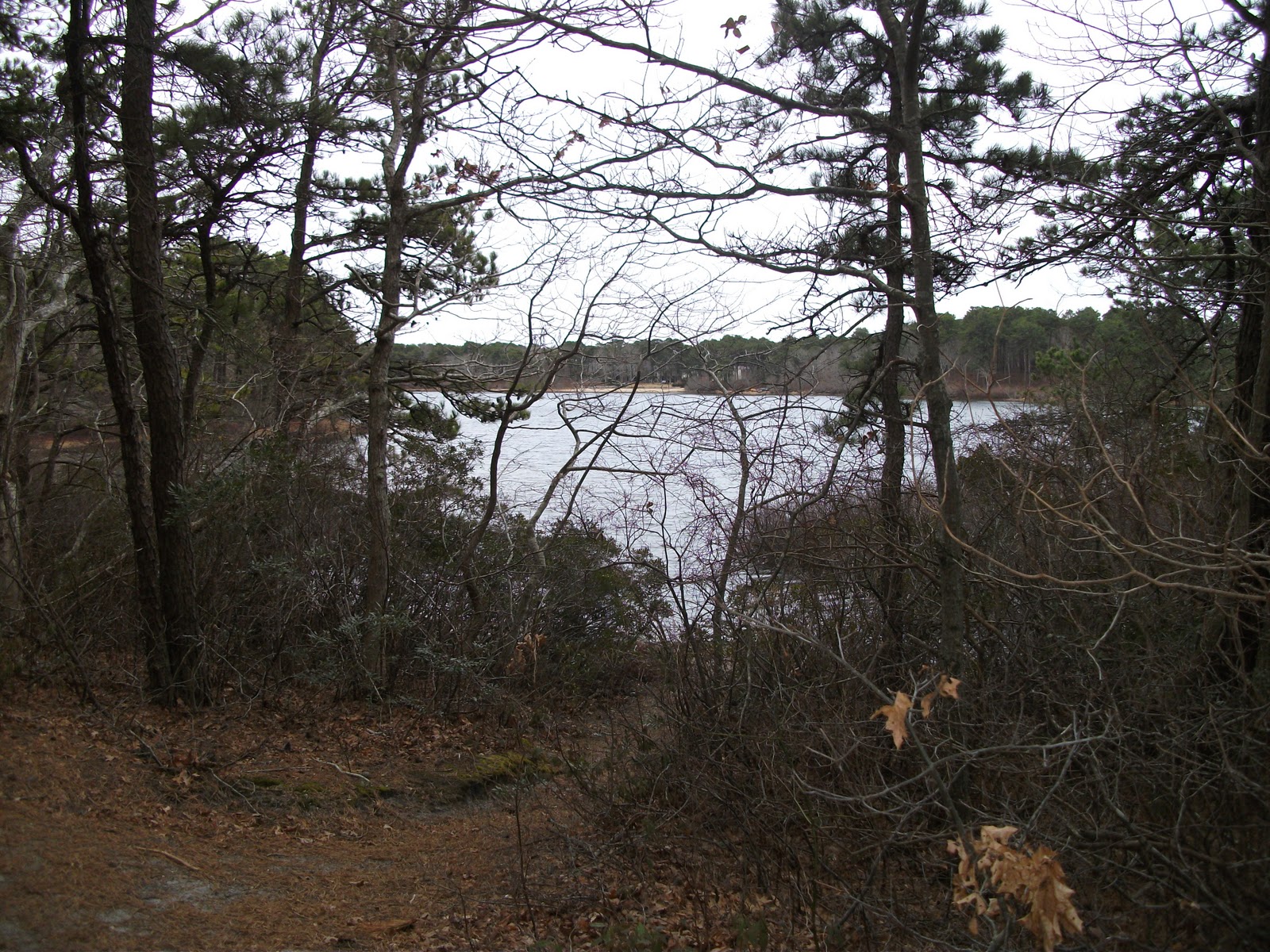
       I didn’t want to take the yellow trail until I finished the orange so I would know the distance. The yellow trail had more hills and was longer, 4 miles, and led to Seymore Pond where it ended and you had to turn and come back. There is only a narrow path to the pond no beach area. The woods were not to thick so the sunshine was nice. Of course there are no leaves on the trees yet.  Horses must travel the trails a lot since I had to keep my head down so I wouldn’t step in there messes.  I found out later that Emerald Hollow Farm has guided tours through the trails The paths on this side were the same as the orange side. Some wide some narrow.
        If you decide to try Punkhorn Parklands stop by Stony Brook Grist Mill which was built in 1751 and is still working today. It uses the force of the adjacent stream to grind grains and corn into cornmeal.  This from Frommer’s;

       “It may be hard to believe, but this rustic mill beside a stream was once one of the most active manufacturing communities in New England, cranking out cloth, boots, and ironwork for over a century, starting with the American Revolution. The one remaining structure was built in 1873, toward the end of West Brewster's commercial run, near the site of a 1663 water-powered mill, America's first. After decades of producing overalls and, later, ice cream (with ice dredged from the adjoining pond), the factory was bought by the town and fitted out as a corn mill, with period millstones. Volunteers now demonstrate and urge onlookers to get in on the action in the restored gristmill. A bag of cornmeal costs $2. The second story serves as a repository for all sorts of Brewster memorabilia, including some ancient arrowheads. Archaeological excavations in this vicinity, sponsored by the Cape Cod Museum of Natural History, have unearthed artifacts dating back some 10,000 years. As you stroll about the millpond, be on the lookout -- who knows what you'll stumble across? “


All in All it was well worth the effort. Nice long hike and a bit of history thrown in!!


For all the pictures click here

Ratings 1- the cellar  2- shoddy  3- tolerable  4- worthy  5- wicked good

Accessibility - 5  easy to find once you know the right directions
Parking - 5- Plenty
Length-   5 - I did over 6 just doing the 2 marked trails
Degree of Difficulty-  3 -easy in parts, but some of the hills are tougher
Dog Friendly-  3 - Some very narrow paths
Trail Markings-  5- Easy to follow with lots of directions
Trail Maintenance-   4 - Kept up by “Friends of Punkhorn” but look out for the many signs of horses.
Variation - 5 - Can mix and match the marked trails and try unmarked
Scenic  - 3 - Not much but being down the street from the gristmill helps
Worth Returning - 4 - Nice length,
Beach -   no
Facilities - no
What I like -  Woods are not thick, the hills, the variety
What I don’t like-  A lot of horse___

Overall Rating-    42  out of 50

Friday, March 25, 2011

Snow Again ???


       Snow !! Are you kidding me !! I have  walked everyday except three in the last five months. I began walking to lose weight so there was no way I was not going to go. I think it was easier when I knew everyday was going to be in the 20’s. A few days ago it was close to 60, just a tease, but at least I can see the light at the end of this long winter tunnel. Oh well back to the layers and The Callery-Darling Trail. Bad weather days are not the time for exploring new trails. I go at least 3 miles on the bad days because I know that on the nice days I will go 5 or more. The great day we had a week ago I did over 7.
       For those of you who would like to lose weight here are some things that helped me:

1 Start slow.  don’t do too much too soon. Try going by time first, 30 mins. Then 45, then an hour
2. Do it everyday no matter what.  I walked sick, injured, in snow, in rain etc
 I was afraid if I missed one day I might stop. The first day I missed was in month 3. If anyone would have told me even 6 months ago That I would have walked Thanksgiving, Christmas and New Years Day I would have told them they were nuts!!
3. Eat better. I didn’t diet - I cut down and ate healthier. I never ate a lot - I ate BAD. Why waste the energy and not eat better too.
4. Don’t look at scale everyday.  It will be like waiting for water to boil. I could tell by how my clothes fit.
5. Do what’s best for you. I was told so many times, he did this…she did that and so on. Find something you like and stick with it. I still get told no don’t do it that way you  should do it such and such a way. I tell them I must have done
6. Keep a log. I didn’t start right away but I wish I did. Around Christmas I got a Mio Pedometer PC. It measures miles, time, steps and calories burned and hooks up to your computer and keeps graphs for you. In February I started recording the data on my own chart. I added which trail I did that day, the temperature and the conditions.
7. Get a friend to do it with you.  If you need a little push to get you going start with a friend. I did, and it was a huge help. In the beginning we kept each other going. Neither one of us wanted to be the guy who quit. My friend had to travel a few times and didn’t have the same affection for the outdoors as me. So now I listen to my MP3 player for company. Another friend helped more than she knows; she would keep asking if I had walked. I never wanted to tell her I didn’t-
I would have felt like I disappointed her.
8.Wear the right clothes. It’s not a fashion show. Wear a hat, layers if need be, Always expect worse weather. Good shoes are a must. I got hiking boots that have been great in the snow, mud, ice and tide pools.
9. Research. I research as much as I can - From the boots to the trails etc.
I found a blog I follow on Kindle called “Weight loss without tears”  that has also helped me out.
10. No excuses!!!
                                          GO TAKE A HIKE !!!

Here is a good link you should READ before hiking on Cape Cod

Wednesday, March 23, 2011

Horse Pond Conservation Trail

     While I was looking at the different Yarmouth Trails I noticed that Horse Pond connected to Sandy Pond to its southwest and to RJ Syrjala to its southeast. I had already figured out how to connect the two when starting out at Sandy Pond. There is a small parking area just south of the Police Station on Higgins Crowell Road. The trail starts by leading east passing a dirt road, that leads to a watershed, and heads toward the pond. The trail loops around and stays to the north of the pond with 3 paths that will bring you down to the water. The third of these has a small sandy area, but mostly the pond is surrounded by woods or private homes. The trail heads south still following the pond and becomes a wide dirt access road that brings you to Buck Island Road. Across the street is a cranberry bog. This bog is east of the cranberry bog that connects to the RJ Syrjala trail. There is another bog to the north of the Syrjala bog on the north side of Buck Island and on the east side of West Yarmouth Road. There are always people and their dogs walking this bog. I had noticed a couple of trails heading into the woods on the other side of the road and wondered if these also connected to Horse Pond. I decided to try and find out. I followed the access road north by another watershed and into smaller trails. There were a lot of smaller sub trails to pick from. I tried to head towards the northeast and where I thought West Yarmouth Road and that bog would be. I passed two small ponds a long the way. I came to a wide path that split three ways, heard a car and headed east where I came out right where I had intended.
       I have a good sense of direction and I knew that these woods had Higgins Crowell to the west, Buck Island to the south, West Yarmouth to the east. I saw trails that led north, that would be left for another day. My car was toward the southwest. One thing I didn’t put into the equation was all the different trails.
I first realized I was going the wrong way when I was on the opposite side of one of the ponds I passed earlier. I was circling back towards West Yarmouth Road. I saw a smaller trail but that led to a small neighborhood I hadn’t seen. I had to get to the other side of that pond. I went back to the trail that brought me to the West Yarmouth Bog. I took a narrow trail and did end up on a bigger trail I remembered I had been on. I was thinking I was heading in the right direction until I saw a paved road with two water stations. How can I be lost when I know where I am !! I kept trying to head southwest hoping to see Horse Pond. I ended up behind Mattakesse Middle School which is just north of the Police Station. I followed a trail south that brought me to the dirt road, with the watershed, I had passed over in the beginning. Wow, it was real good to see my car.
       The next day I went back but parked at the West Yarmouth entrance. I kept going west  on a wide trail disregarding the many trails to the north and south. I passed the two water stations on the paved road I had seen the day before. The trail leads to Bayberry Golf Course and heads south from there. I looped back around, not straying to far off the main trail. The north side trails will also lead to the golf course and we know the south trails will eventually lead to Horse Pond with many different paths to choose from.
       This morning I went back to the trail I have done the most…Callery-Darling….Very nice sometimes not having to wonder where you are !!


Follow on Facebook


Ratings 1- the cellar  2- shoddy  3- tolerable  4- worthy  5- wicked good

Accessibility - 5  easy to find, just south of  Police Station
Parking - 3- small area
Length-   2- Horse Pond itself is .92 miles -- 5   with all the connecting trails it can be as long as you’d like
Degree of Difficulty-  3 -easy with some hills , can be confusing
Dog Friendly- 4
Good for Family- 2 -   nothing extra
Trail Markings-  2- easy to get lost with so many sub trails
Trail Maintenance-   4-.
Variation - 5 -  Can connect to many trails
Scenic  - 2 - A ways back from pond, woods mostly

Beach -   very small sandy area by the end of the pond

What I like - Challenging trying to find the connecting trails
What I don’t like- Pretty much all woods

Overall Rating-    32 or 35  out of 50

Monday, March 21, 2011

Long Pasture Wildlife Sanctuary

One of my friends lives by Long Pasture Wildlife Sanctuary, off of Rte 6A in Barnstable. It’s very easy to find, There is a sign for Harbor Point Restaurant at the beginning of the street, My friend can walk to a path in the backyard that goes to the beach which eventually leads to some steps that bring you to the trail, but not at high tide. Of course the day I went it was high tide. No big deal, just walked up the street to the pasture and started there. The trail almost looked like it was mowed. The path a bright green, haven’t seen that color since the middle of Fall, contrasting with the slightly taller brown grass that surrounds it. The Sanctuary is on both sides of Bone Hill Road. The west side consists of a group of trails that connect through the meadow. The trails are well marked with signs for each trail. Woodstock trail loops through bushes ending at 6A. Beck Family trail connects with it and brings you through Buttonbush Swamp and an old cornfield over to Harbor Point Rd. You can take Bone Hill trail across the street to the Spruce Forest that leads to the harbor, the visitor center, a butterfly mosaic and Ocean Song farm. The farm is small and has goats, turkeys and pigs. Long Pasture has the meadow, woods and the beach al in one, a good walk on a nice day.
         Another friend asked if I had seen any wild animals. Well the second day I did Long Pasture I saw a woodchuck. It was fast though, I reached for my camera and it disappeared. I need to practice my quick draw I guess. I have seen a lot of rabbits, but that’s it so far. One morning it was snowing so I went to my “home trail” Callery-Darling. No one else had walked it yet as there were no other footprints. I noticed some dog prints, not paying much attention until I realized 2 things. The first was that there were no people prints to go with them. The second was that they didn’t follow the trail. I had been told of coyotes, but that was the first time I saw signs of them. When I got to the end of the first part of the trail that day I saw a nice big thick stick. It was a little slippery that day because of the snow so I picked it up. Not only was it a perfect walking stick, but a perfect coyote stick ,just in case, lol.

To see all my trail pictures I have started a page on Facebook click -    Hike Cape Cod - Facebook


Ratings 1- the cellar  2- shoddy  3- tolerable  4- worthy  5- wicked good

Accessibility - 5  Bone Hill Rd off of 6A
Parking - 5 - across from pasture and at Visitor Center  $4 donation
Length-   4 - Can make it longer at low tide
Degree of Difficulty-  5 -easy with some hills
Dog Friendly- 2  not allowed in main area
Good for Family- 5 -  Kids will like the animals
Trail Markings-  5  Best yet - Signs pointing the way to all trails, harbor and visitor center
Trail Maintenance-   5-. Very well kept
Variation - 3 -  can change it up a little, but not much
Scenic  - 4 - Beautiful view of harbor

Beach -   access to walk - good at low tide

What I like - Pasture part is good for sunny day, can add miles at low tide
What I don’t like-  $4 - I know it’s for a good cause

Overall Rating-    43 out of 50

Saturday, March 19, 2011

Sandy Pond, West Yarmouth & Corporation Beach, Dennis

           Spring is in the air!!! Almost 60 degrees which felt even warmer after walking in 20 degree weather all winter. The heavy rain had cut my hike short the day before at Sandy Pond. There were 2 paths I didn’t get a chance to find out where they led so I went back to find out. The main trail of Sandy Pond circles around the pond with a connecting trail that heads north around the half way point. The trail breaks to the east and heads to the beginning of Horse Pond Trail. The west trail loops back to the south, which leads behind the fire station and an old access road bringing you back to the parking lot. When the trail starts to loop back there are two other trails, one to the west and one that leads north. The west trail turns south and ends up at Buck Island Road close to Camp St. If you are driving or even walking on Buck Island you would have no idea there was a trail there. I laughed when I thought of what people driving by thought, what this guy coming out of the woods climbing over the guide rail was up to.
The trail that went to the north ends up at Chandler Gray Cemetery that is off of Higgins Crowell Road north of the school and police station. All in all the Sandy Pond Trail was much better than I was led to believe. The trail, beach, life course, courts and ball fields make it a real nice destination.
             I was all set to try Horse Pond, which not only connects to Sandy Pond but follows the north side of the pond with other connecting trails to Basset’s Lot Pond, Plaches Pond cranberry bogs and eventually to R.J. Syrjala Trail. I didn’t. It was such a nice day I went to Corporation Beach in Dennis. I timed it perfect, low tide, so the walk from one end to the other is a little over a mile. During high tide the walk would be less than half that. The water comes in so far there is hardly a beach. The next couple of months on the real nice days are the time to walk the beaches. Summer time, not only are they packed with tourists, the towns charge at least $20 a day to park. All the towns sell summer long passes to residents, some do for non-residents, and they all sell weekly passes for tourists. So Horse Pond lost to the beach that day and The next 2 days because a friend invited me about another to hike another trail I hadn’t heard of - Long Pasture Wildlife Sanctuary- which will be tomorrows post.
                              

.

Ratings 1- the cellar  2- shoddy  3- tolerable  4- worthy  5- wicked good

Accessibility - 5
Parking - 5 - Free all year
Length-   2 - If you stay at Sandy Pond but you can make it a 5 if you head to Horse Neck Trail
Degree of Difficulty-  4 easy with narrow trails
Dog Friendly- 3  better in other part of park
Good for Family- 5 - tennis courts , basketball court , soccer and softball fields, playground, beach and facilities,
Trail Markings-  5  Cape Cod pathway stickers on trees along with direction signs
Trail Maintenance-   5-. Well traveled
Variation - 4  thanks to connecting trails and the life course
Scenic  - 2-  can see the pond

Beach -   fresh water

What I like - The park
What I don’t like-  it’s not very challenging

Overall Rating-    40 out of 50

Wednesday, March 16, 2011

Sandy Pond, West Yarmouth

      I live in Yarmouth which is considered the Mid- Cape. I also live in between Nantucket Sound to the south and Cape Cod Bay to the north. This makes it easy to travel to the many trails in the different towns of The Cape. The truth is there are so many trails in Yarmouth, It’s easier not to have travel to far, especially on crumby days. Only recently now that there is a glimpse of spring in the air did I decide to explore different trails and beaches. So far in March when it has been a nice day, not only do I want to hike farther, I want to travel farther to do it. Yesterday was sunny but cold and today was warmer and pouring, So I stuck close to home.
      Sandy Pond is at he back of a recreation park. It has a  softball and soccer field, Tennis and basketball courts and a playground, with facilities. To get to the pond, which has a small swimming beach you walk down the hill behind the ball field. It is located off of Buck Island Road in West Yarmouth.  The only times I had gone there before was to shoot baskets. Friends had told me about the trail that they said went around the whole pond, about 1 ¼ miles  It wasn’t long enough I told them, if I want to go in circles I will go to a track. That’s not happening! I had to enough laps playing sports as a kid.  My friends never told me of the connecting trails that either can make Sandy Pond trail longer or actually connect to other trails like Horse Pond.
         The main trail is narrow and follows the pond all the way around. On the soccer field side is a life course  with 6 stations. There is a connecting trail about half way around the trail. It starts off heading north before it splits. Someone put small signs with directions on a few trees that are very helpful. Going to the east will take you past water stations to Higgins Crowell Road and the beginning of Horse Pond Trail. Heading west  leads you back towards the pond, giving you an option of a outer loop to add mileage. Before the west trail loops back you have a choice to north for a short distance before it splits again. I haven’t checked out those trails yet  because of the pouring rain. I thought I was going to be able to start Horse Pond tomorrow but I guess we will see where the other trails lead first. Sandy Pond has turned out much better than I expected. Hopefully it will be nice tomorrow and not only will I find where both these trails lead but I can hike over to Horse Pond too.


http://www.yarmouth.ma.us/DocumentView.aspx?DID=705
.

Ratings 1- the cellar  2- shoddy  3- tolerable  4- worthy  5- wicked good

Accessibility - 5
Parking - 5 - Free all year
Length-   2 - If you stay at Sandy Pond but you can make it a 5 if you head to Horse Neck Trail
Degree of Difficulty-  4 easy with narrow trails
Dog Friendly- 3  better in other part of park
Good for Family- 5 - tennis and basketball courts , soccer and softball fields, playground, beach and facilities,
Trail Markings-  5  Cape Cod pathway stickers on trees along with direction signs
Trail Maintenance-   5-. Well traveled
Variation - 4  thanks to connecting trails and the life course
Scenic  - 2-  can see the pond

Beach -   fresh water

What I like - The park
What I don’t like-  it's not very challenging
Overall Rating-    40 out of 50

Monday, March 14, 2011

Flax Pond Conservation Area - Dennis MA

The day after hiking Crow’s Pasture was raw, cloudy, cold and windy  That trail is perfect for a nice day since part of it is wide open and leads to the beach. I decided on a place I had driven by many times but had never tried.
      Flax Pond Conservation Area in Dennis off of Setucket Road was a nice find(about 2/10 a mile past the Yarmouth/Dennis town line). This trail has many choices and that’s part the reason it has been so long since my last blog. I wanted to hike the whole trail and each time I have gone back, I found another trail I wanted to explore. I went four times this week, finding something new each time. The other 3 days I went twice to my “home trail” - Callery-Darling - and once to Chapin Beach since it was another especially nice morning in March.
      From the small parking lot follow the access road past the power lines about ¼ mile to Flax Pond. There are two choices - left or right - Left brings you around the pond but just as you get around the corner there are 4 or 5 no trespassing signs. There is a sub-trail leading away from the beach that goes up a decent hill that will bring you to  the power lines and loops back to the access road.
       Taking a right at the pond starts up a hill and gives you another left/right choice. The left trail (A) is wide and keeps going up with the pond on the left. It starts going away from the pond and heads past some watersheds and to Dennis Highlands Golf Course which will be on your left.. The right trail (B), which is also nice and wide, heads down away from the pond. The B trail keeps going until it comes to another access road. Going to the right leads you to Setucket road and is about a mile from the pond. Going to the left you will see Dennis Highlands Golf Course on your right, and will connect with A by the watersheds.  In between A and B is dense hilly woods. There is a third wide path that cuts the two in half and many sub-trails that connect them all. Some of these are very big hills. There are also many sub-trails that connect to the many surrounding neighborhoods.


Ratings 1- the cellar  2- shoddy  3- tolerable  4- worthy  5- wicked good

Accessibility - 3 Have to know where it is or you drive right by
Parking - 5 - Free
Length-   5 - Very good with all the trail choices
Degree of Difficulty-  3- 5   the main trails are easy the sub-trails can be very hard with very steep hills and very narrow paths
Dog Friendly- 5 - the dogs seem friendlier than the people
Good for Family- 4 - wide paths not much of a beach area
Trail Markings-  4  easy to follow but can be a little confusing at first
Trail Maintenance-   5-. Well traveled
Variation - 5-  so many choices
Scenic  - 2-  can see the pond at  the beginning

Beach -   fresh water

What I like - Plenty of choices
What I don’t like-  plenty of choices (lol)  some days you don’t want to have to choose

Overall Rating-    41-43 out of 50

Monday, March 7, 2011

Crow's Pasture, East Dennis

      It is heading toward the end of the winter on Cape Cod. The good part is a day like yesterday. 50 degrees that felt like 70. When we have a day like this I call it ……… What a day, What a life, What a country. The first of 2011 and hopefully we have many more to follow. Since it was so nice I decided to hike a trail I have wanted to try but hadn’t yet. I decided on Crow’s Pasture in Dennis, and am I glad I did.
        Crow’s Pasture is off of Rte 6A by the Dennis - Brewster line. Go north on School St. and take the first right which is South St., follow to the end of Quivet Cemetery and park in the posted area if you want to hike the whole trail. There is a narrow dirt road that goes toward the beach with more parking along the way.
         You start off walking through a narrow wooded trail with a big marsh to your right. There are a few paths off the trail that give you a nice view of the marsh. The trail leads to a wide open pasture with the marsh on one side and the ocean ahead. Even though it is wide open you can see the trail that winds around the perimeter. The other side is the dirt road which leads to the beach for permitted off road vehicles. In my younger my friend Pete and I would go 4-wheeling late night, calling it Rat Patrolling, named for a WWll  tv show in the 60’s, but that’s some stories for another day.
           Once at the beach I first went east and walked for about a mile before I turned back. It was so nice I walked by the tail entrance without even noticing.
I came to the point where the water goes into the marsh area before I realized. I found it when I was looking for it, and this time followed the dirt road. It seemed like it was leading me away from where I started. A few vehicles drove towards the beach and I came across some other people enjoying the day. I was curious where this road would come out. There were a few hills and curves. I came around the last corner and there was my car. Huh !! I thought I was going the other way, lol. On the way out I decided to go to Dunkin Donuts on 6A in Brewster, which was about 2 miles away for a coffee. I noticed at least 2 more trails to explore another day!! Awesome !!


 FOR ALL THE PICTURES BECOME A FAN AT
http://www.facebook.com/pages/Hike-Cape-Cod/155434604514654?sk=wall

Ratings 1- the cellar  2- shoddy  3- tolerable  4- worthy  5- wicked good

Accessibility - 5
Parking - 5 - plenty - in more than one area
Length-   5 - 3 miles to. beach and back -add more with beach
Degree of Difficulty-  5   easy
Dog Friendly- 5 - pasture and beach supply open areas
Good for Family- 5 - same as above
Trail Markings-  5  easy to follow
Trail Maintenance-   5-.
Variation - 2 - can a little but mostly to the beach and back
Scenic  - 5- Wow

Beach -   Crowe’s Pasture

What I like - Great for a nice day, The mixture of wooded trail - pasture then beach
What I don’t like- not for inclement weather

Overall Rating-    47 out of 50

Sunday, March 6, 2011

Dennis Pond - Yarmouth

Yesterday, cloudy and about 40, I decided to try a different trail, Dennis Pond, which is located off of exit 7 on Rte 6 on Willow St.. Head north toward 6A . There is parking for about 5 cars on the right just as you see the pond. The first thing I noticed was a sign on a tree warning that the area was under surveillance. Strange, I thought I hadn’t seen it before. I found out later that it had been a popular cruising area a few years ago. There was a big crackdown and the cameras are there so it won’t happen again. Kind of glad I didn’t know until later.
        The trail follows along the southern part of the pond. It is a narrow hilly trail with big roots making the hike a little more challenging. The main trail, which has a few short trails that go to the pond, ends at Summer St. just south of  Dennis Pond Beach. The main trail covers about a mile. There are two side trails one at the beginning that loops around to the main trail and another halfway that goes up a hill to power lines. I’m not sure if you are allowed to walk these or not, if so you can add as many miles to your hike as you’d like.


Ratings 1- terrible  2- poor  3- ok  4- good  5- great

Easy to find - 4
Parking - 2  - about 5 cars on Willow St and 2 cars on Summer St.
Length-   3  - .93 miles from one end to the other with side trails can add more.
Degree of Difficulty-  3  -narrow trail, big roots and hills
Dog Friendly- 3
Good for Family- 2 -not for young children
Trail Markings-  4  easy to follow
Trail Maintenance-   3 - fallen tree on loop trail have to climb through it to continue or turn back.
Benches -   1 - old one over looking  pond
Scenic  - 2 - can see pond this time of year
Beach -   Opposite side of Dennis Pond Beach

What I like - A lot of hills
What I don’t like- trail is too short

Overall Rating-   27 out of 50

Friday, March 4, 2011

Take A Hike Yarmouth 2

       Yesterday and today I walked the Raymond J. Syrjala Conservation trail. I only had walked here once before,  as opposed to The Callery-Darling trail which I walked 20 times in February. The first two times it was sunny, windy and in the low 20’s. Today was nice at 34, lol. Some friends think I’m crazy to walk outside i winter. I suppose I am, but I just am not a treadmill or fitness club guy. I’d rather be outside. Since I have lost more than 60 lbs my old clothes still fit with the extra layers I wear. I bought Propet Camp Hiker waterproof boots that have helped in the snow and mud, on ice and tide pools. I listen to my MP3 player and keep track of my miles and calories burned with a Mio Pacer PC. I’m still a beginner so I would really like to know what others use while hiking..
        I have driven by where The Syrjala begins hundreds of times and had no idea it was there. From  Rte 28 take Winslow Gray Rd about a ½ mile, on the left there is a small park that looks like one of those places that’s dedicated to someone but nobody ever uses. A narrow path with plenty of boardwalks wind through red maple swamps, with Plaches Brook on one side and a cranberry bog on the other. The path circles back to almost where you started with another path that cuts through the middle. Because of that it makes it to short for me. Callery-Darling is spread out so if you walk the whole trail it is close to 5 miles. What makes this trail worth going to for me is the cranberry bog it connects to. You can add as much mileage to your walk as you want. At least 2 miles. I did the trail first then the bog and then the trail again. Have you done this trail? Let me know what other things I should rate.


Length- 1.75 miles plus cranberry bog
Degree of Difficulty- easy  no hills
What I like - The narrow trail is good for windy days, the bog adds length, don’t have to go the same way all the time
What I don’t like- trail is too short. Walking the bog when it’s cold and windy
Dog Friendly- yes
Good for Family- single file
Trail Markings-  Blue Cape Cod Trail  stickers on some trees
Trail Maintenance-  Fallen trees  from storms covering some of the boardwalks. Some of the boardwalks need minor repair
Benches - 2 -one overlooking pond
Scenic  - No
Beach -  No
Overall Rating-  2.5 out of 5

For more info -http://www.yarmouth.ma.us/DocumentView.aspx?DID=704

Thursday, March 3, 2011

Yarmouth Trails Part 1

         If I expected to lose weight I realized I needed to walk everyday. I walk at least 3 - 5 miles a day  I enjoyed walking  beaches but most days in the winter are very windy and cold, walking 4 times around the inside of the mall was worse. Walking the trails burns calories at a much faster rate so I googled hiking, trails, walking, whatever I could think of to find new places to walk. To my delight there were many choices. I live in Yarmouth and I found 9 listed conservation trails. Once I started I was hooked. The best part of hiking is most of the time you’re not going from pt. A to pt B, turning around and going back again. When you walk a trail you never know what is around the next turn or over the next hill. So many times hiking Cape Cod you come across a beautiful scenic view that can literally take your breath away.  
        The Callery-Darling trail at Gray’s Beach. (aka Bass Hole) is one of these.
One of the more popular attractions is the 800 ft. boardwalk that overlooks  the salt marshes and the sea , and looks totally different with the changing tides. The trail has many entrances, I use the one that is by the playground. There is no sign that leads you to the trail but you can clearly see where it starts. From Rte 6 take exit 8 north to rte 6A. Follow Old Church St. across the road to the end and take a right on Center St. this brings you to Grays Beach where you can park for free all year.
.
Length- 2.4 miles
Degree of Difficulty- moderate
What I like - Good length for daily walks, views, has 3 parts so trail can be done whole or split up
What I don’t like- When there is heavy rain there are many deep puddles that will become very icy in winter or very muddy the rest of the year
Dog Friendly- yes
Good for Family- yes
Trail Markings- ½ way there is a wooden map
Trail Maintenance- very good
Overall Rating-  4 out of 5
http://www.yarmouth.ma.us/DocumentView.aspx?DID=699


Tuesday, March 1, 2011

Even in Winter

      I Live in Cape Cod . An island off the Massachusetts coast that attracts numerous tourists every year. IN THE SUMMER . It is easy to walk then, I started walking seriously at the end of October with a friend to try and lose weight.. We had talked about starting for months. You know the story…we’ll do it tomorrow, then tomorrow would come but one of us would have an excuse.
I weighed about 330 lbs when we began. Once we started even to our surprise we walked 3 miles every morning. We leaned on each other, some days it was easy, and some were uugghh !
We walked a couple of different beaches and on the real bad weather days we would walk the mall, which I hated. By Christmas I had lost 30 lbs, and my walking partner. I kept it up by myself, but needed new places so my walking wouldn’t turn into a chore.
I started researching different places to walk. Well it turns out The Cape has many trails in each of the 15 towns that occupy it. I found The Callery-Darlng  Trail at  Grays Beach first, which features an 800 ft boardwalk that offers a unique perspective of the salt marsh it overlooks.
I started finding more trails to check out. Most of the people who I talked to had never heard of the trails. I enjoy hiking these trails and would like to share my experiences with people who live or are planning a vacation in Cape Cod.
So I decided I will write about the different Cape Cod trails, explaining the good, bad, where to find them, length etc. By the way Total Weight Loss so far 65lbs. And counting !!